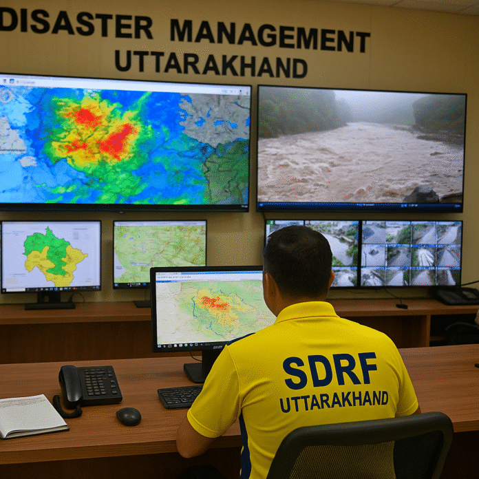
In a state where steep mountains meet swift rivers, the monsoon season has always brought both life and danger. But Uttarakhand’s government is showing that the risks of living in a climate-vulnerable Himalayan region can be reduced through a mix of technology, training, and fast decision-making. Under Chief Minister Pushkar Singh Dhami’s leadership, disaster management has moved from being reactive to proactive — and in many cases, preventive.
From Forecast to Action in Minutes
A network of high-tech control rooms now operates across the state, with the State Emergency Operation Centre in Dehradun acting as the nerve centre. Linked directly to the India Meteorological Department (IMD), these hubs receive live weather updates, river-level readings, and landslide alerts.
When the IMD issues a rainfall or landslide warning, the information is instantly shared with the Uttarakhand State Disaster Management Authority (USDMA), which coordinates with district-level control rooms. This streamlined communication ensures that instructions reach field officers, local police, and the State Disaster Response Force (SDRF) within minutes.
Case Study: Early Evacuation in Chamoli Saves Lives
During the July 2025 monsoon surge, heavy rainfall triggered a landslide above a small hamlet in Chamoli district. Remote sensing data picked up unusual soil movement in the early hours, and a drone reconnaissance confirmed cracks expanding along the slope.
Within 45 minutes of the alert, SDRF teams were on-site, guiding over 80 residents to temporary shelters in the local school building. By afternoon, the hillside collapsed, blocking a road and burying farmland — but no lives were lost. Villagers later credited the rapid warning and evacuation for preventing a tragedy.
Technology in the Hills: Drones and Remote Sensing
The use of drones has become a game-changer. Fitted with high-resolution cameras and thermal sensors, these drones are flown over vulnerable valleys and road corridors to check for developing cracks, waterlogging, or unstable rock faces.
Satellite-fed remote sensing systems track rainfall saturation in soil layers, helping experts predict landslides before they occur. This data feeds directly into the control rooms, where trained analysts convert it into actionable alerts.
Training the Responders
The SDRF, already known for its mountain rescue skills, has undergone specialised monsoon preparedness training. This includes swift-water rescue techniques, rope-based extractions from landslide zones, and first-aid care tailored for disaster injuries.
Villages in high-risk belts are also being trained in community-based disaster preparedness, with mock drills ensuring that people know evacuation routes and safe assembly points.
Tourism Safety and Rapid Response
Given that Uttarakhand attracts millions of pilgrims and trekkers each year, tourism safety has been integrated into the disaster plan. Major routes like the Char Dham circuit are now equipped with digital boards displaying weather alerts, and police checkpoints double up as information points for travellers.
In case of a sudden weather change, coordination between tourism officers, SDRF units, and district control rooms ensures that routes can be closed and tourists diverted before danger strikes.
A Proactive, Not Reactive, Approach
By marrying early warning systems with ground-level readiness, the government is setting a benchmark for hill states. Chief Minister Dhami has repeatedly stressed that “technology and training are our strongest allies in protecting Uttarakhand’s people.”
The results are already visible: faster evacuation times, fewer casualties in high-risk events, and growing public trust in the state’s ability to manage the monsoon’s fury.


